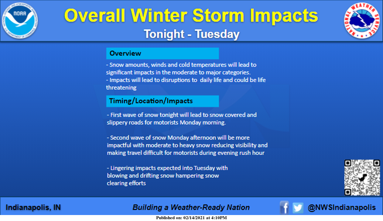
NWS Update at 1:30 pm Monday: Heavy snow with reduced visibility
/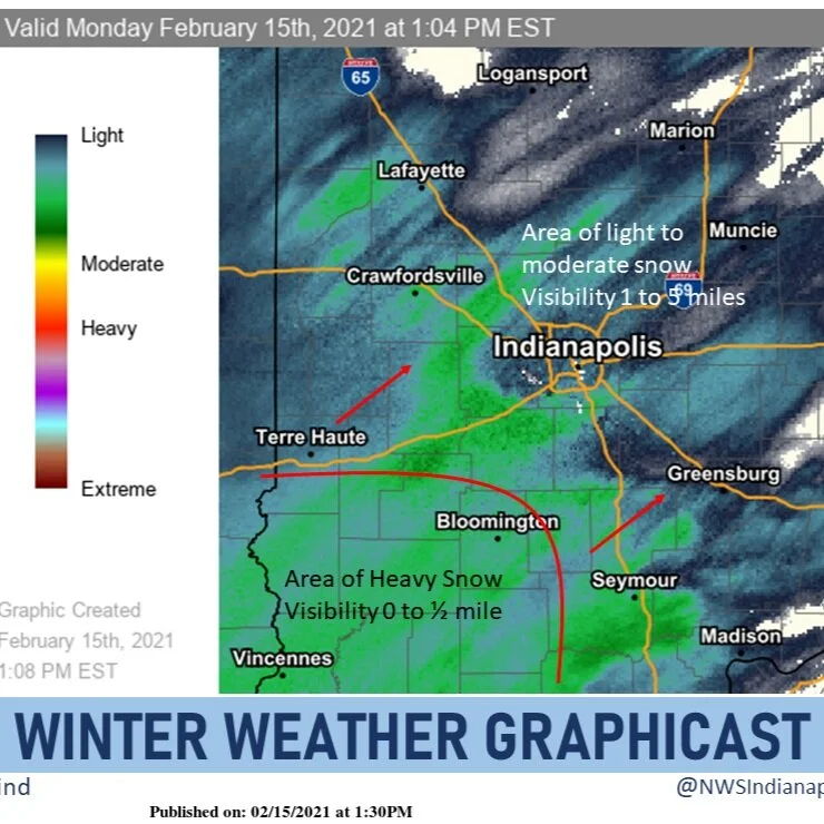
Heavy snow is overspreading central Indiana from the southwest. Snowfall rates of over an inch an hour are possible. Visibilities in the heavy snow in areas such as Vincennes and Bloomington will be a quarter mile or less at times, and this area of snow is expanding northeastward.
Read More